Automated Trail Inspections
Automated trail inspections uses images captured from a smartphone or action camera to quickly detect issues like cracking, distortion or other damage, enabling faster maintenance and safer trails. This technology streamlines reporting, reduces manual labor, and improves trail management for long-term sustainability.
Categories:

Implementing an effective program for managing trails and sidewalk condition present several unique challenges as compared to other transportation assets like roads or bridges. Primarily, these networks are used by pedestrians, with safety being the primary driver of a management strategy. These networks are used by modes of use including, walking, biking, wheelchair, walkers, etc.). These diverse usages are key factors that RSI considers in its comprehensive approach to managing these assets.
Our solution (RUBIX) automatically collects various types of performance data along a Trail network. Once collected, our platform analyzes the data and sends it to a live dashboard that displays the information in a geospatial format. Stakeholders can then take proactive actions, build maintenance strategies, and develop budgetary plans to meet the defined service levels.
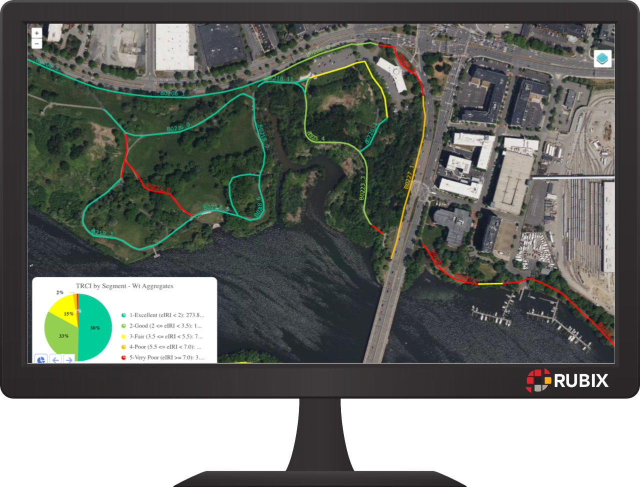
Motion and location information collected from smartphones device are automatically processed and produces a classified Trail Condition Index (TRCI) indicating the relative smoothness of a trail. The TRCI data is represented at different levels of detail, mainly:
- Short Intervals (shown below) used to identify hotspots
- Segments (shown on the right) for network level ranking and analysis
- Groups of Segments for higher level comparison of overall Trail Systems
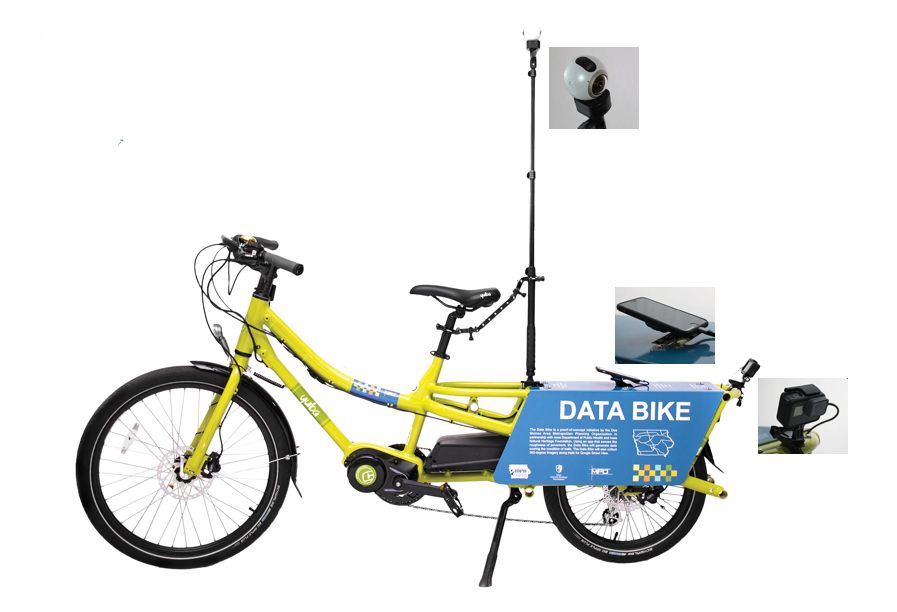
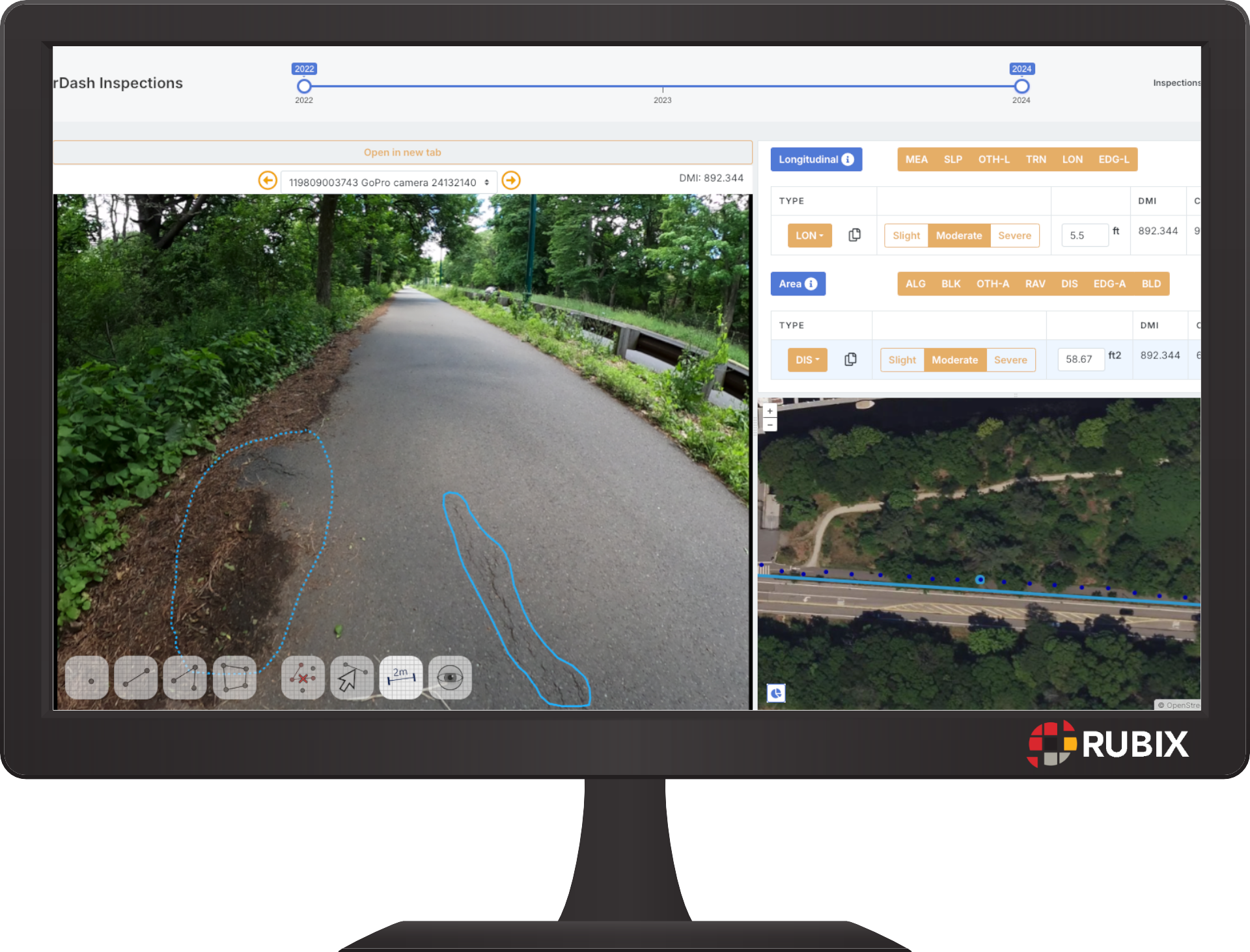
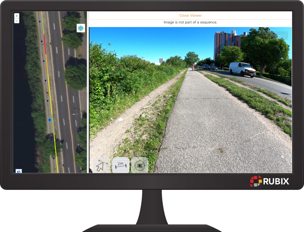
A Fully integrated web image viewer allows users to easily navigate and virtually drive through trail images collected from a smartphone or action camera. Images are automatically link to a GIS map and can be downloaded, with the ability to blur sensitive content like people’s faces and licence plates. The RUBIX image viewing capability supports both 2D planar images as well as 3D panoramic images.
For more advanced analysis, images can be analysed through the RUBIX AI module, rVision. This workflow detects more detailed surface defects on trails such as cracking, edge defects, and potholes. These detects are classified in terms of the severity (width of crack) and extent (computed areas or lengths) of the affected areas. These details are further rolled up to produce a Surface Condition Index representing the overall surface quality of a Trail.
The solution offers a simple, cost effective approach to rapidly inspect and inventory your Trail network.